

Image credit: Nature
RiceExtent v1.0: A New Global Map for Rice Cultivation
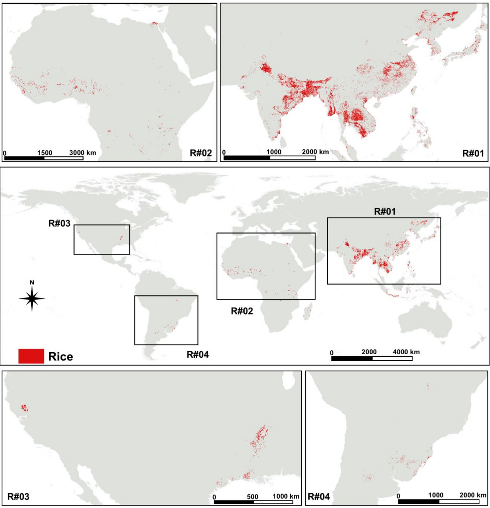
Researchers have recently released RiceExtent v1.0, a new global map detailing areas dedicated to rice cultivation. Published in the journal *Nature* on October 21, 2026, this product represents a significant advancement in monitoring and understanding global rice production. The map utilizes data integration from various satellite sources to provide a detailed and consistent picture of where rice is grown worldwide.
What is RiceExtent?
RiceExtent v1.0 is a land cover product specifically designed to identify and delineate areas used for rice cultivation. Unlike general land cover maps, which may categorize rice fields as ‘agricultural’ without specifying the crop, RiceExtent focuses solely on rice. This allows for more precise analysis of rice production trends and regional variations.
How Was It Created?
The map was developed through the integration of data from multiple sources, including Sentinel-2 and Landsat satellites. These satellites provide different spectral resolutions, allowing researchers to combine the strengths of each to improve the accuracy and detail of the map. The research team employed sophisticated image processing techniques to harmonize the data and create a single, comprehensive product. Details on the specific algorithms and methods used are available in the original *Nature* publication.
Key Features and Benefits
Several key features make RiceExtent v1.0 a valuable tool for various stakeholders:
- High Resolution: The map offers relatively high spatial resolution, allowing for the identification of smaller rice fields.
- Global Coverage: It provides coverage for nearly all regions where rice is cultivated, including areas with limited historical data.
- Multi-Source Integration: Combining data from multiple satellites improves the robustness and accuracy of the map.
- Temporal Consistency: The product is designed to be consistently updated, allowing for long-term monitoring of rice cultivation patterns.
Implications for Research and Policy
The availability of RiceExtent v1.0 has several practical implications. Researchers can use the map to study:
- Changes in Rice Production: Track shifts in rice cultivation areas over time, potentially linked to climate change or economic factors.
- Regional Variation: Analyze differences in rice cultivation practices across various geographic regions.
- Agricultural Policy: Inform decisions related to irrigation, fertilizer use, and other agricultural policies.
Beyond research, the map can be useful for organizations involved in food security, disaster management, and environmental monitoring. For example, it could be used to assess the impact of floods or droughts on rice production or to monitor the expansion of rice cultivation into sensitive ecosystems.
Accessing the Map
RiceExtent v1.0 is publicly available for download through the official website (replace with actual link when available). The data is provided in various formats to accommodate different user needs. Details about the data’s license and usage restrictions are also available on the website.
Further Information
For more information about RiceExtent v1.0, including the technical details and methodology, please refer to the original *Nature* article: Nature Publication Link (replace with actual link when available).
Based on reporting by Nature. Read the original report.


Leave a Reply